The Swiss Way of St James: section Sachseln - Brünig Pass
On the road as a tour guide with the UBS Zurich Berg & Ski sports club. The weather forecast promised a midsummer day with high humidity and local thunderstorms. 12 Berg & Skiler nevertheless dared to hike along the Way of St. James - rain protection within easy reach.
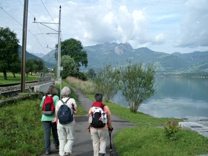
On the romantic lake trail we walk directly from the Sachseln railway station to the historic Landgasthof Zollhaus, a former customs station on the old trade route.

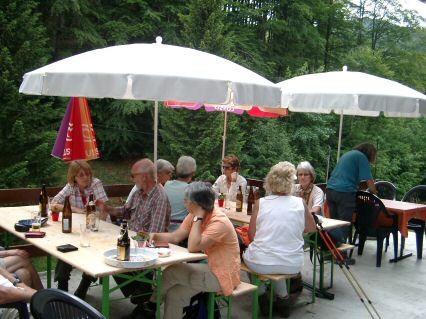
At the end of Lake Sarnen the much longed for coffee and many croissants are already waiting for us.
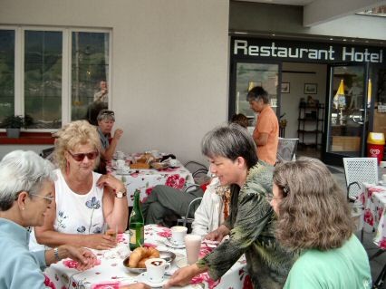
A capuccino is currently being served here.

The Way of St. James now takes us on a cycle path to Diechtersmatt. "What's dripping out of your backpack?", I'm asked. Oh dear, the closure on my water bottle was not closed properly. A bitter loss at these temperatures.
In between I have to watch out for bicycles that approach silently from behind and whiz by.
We walk through the scattered settlement of Giswil, admire the beautiful, well-kept farmhouses and visit the chapel. Because of its favourable strategic location, the village
possessed once three fortified castles of which not much is left.
The first ascent begins at the end of Giswil. With a moderate gradient, the route leads through the forest up to the viaduct of the national road. There we cross the road and return to the clearly recognisable, historic Brünigweg. It is a thoroughly romantic path. Who would have thought it - so close to the Brünig-road traffic axis. The shady Kaiserstuhl forest should actually provide pleasant freshness. But there is not the slightest breeze and it is eerily muggy. The water consumption is enormous.

At the summer pasture we leave the forest and after a short ascent we reach the village of Kaiserstuhl.

The Lake Lungern is reached and it presents itself in all its beauty.

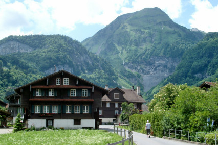
On the riverside path we enjoy the stylish Obwald farmhouses.

In Bürglen we visit the charming St. Antonius Chapel, which dates back to 1686. The chapel was enlarged at the beginning of the 1830s and was consecrated to the Virgin Mary, Anthony and Wendelin. A special pleasure is the hike along the quiet lakeside landscape to the upper end of the lake before Obsee. This village is characterised by many beautiful farmhouses which blend harmoniously into the landscape.

This resting place above the Lungernsee was ideal for a leisurely lunch stop.

At the end of the Lungernsee we walked past the impressive Dundelbach waterfalls and arrive in the small village of Obsee.

The Chapel of St. Beatus in Obsee was built during the turmoil of the Reformation in 1567 as a welcome alternative pilgrimage site to the Beatus Caves on Lake Thun. It contains images of the Beatus legend.
After the chapel, there is the last flat section - here "Im Rietli" - before the ascent to the Brünig begins.
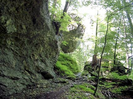

The "old Brünig path" ("Käppelistiege"), signposted as the Way of St. James, takes us up into the forest. Here we find traces of the Roman path through the saddle forest. In several places we can clearly make out old, carved-out steps,

Slab paths and wagon wheel channels from the Roman period. Along a historical wall path we continue our walk to the Chäle. After crossing the Brünig National Road we come to a particularly unspoilt forest landscape. The romantic forest path runs between rocks and boulders.
We get back to the national road. Actually we have almost reached the height of the Brünigpass. But the Way of St. James first leads us down again, away from the road to a mountain pasture (Sewli) about 60m below.
Now it goes up again and very soon the path leads along the tracks of the Brünigbahn with its toothed track. We pass the cantonal border Obwalden-Bern.
Five minutes before the Brünig Pass we stop at the Friends of Nature House. Because of the oppressive sultriness, the thirst is great and we are happy about the well-deserved stage beer.

The Brünig Pass (1008 m) is reached.
We were lucky with the weather. The whole day we hiked in the sunshine, while heavy thunderstorms and downpours raged all around us.
Thanks to St. James (or St. Peter)!
The link "Giswil" refers to the history of the three castles.

previous stage

next stage