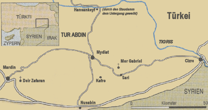
The landscape of Tur Abdin (Aramaic: Mountain of the Servants of God) is located in the southeast of present-day Turkey, in the north of Syria and in the northwest of Iraq. To the east of Tur Abdin is the city of Cizre , to the west the city of Mardin, to the south Dara and Nusaybin, to the north Siirt and B'sheriye. The west-eastern extension is about 200 km, the north-south about 150 km. Administratively, Tur Abdin belongs to the city of Mardin. Mardin has 12 districts, 11 counties and 688 villages, 650 km² of the area belonging to it are forest.
Tur Abdin forms a plateau, which is on average 990-1200 m above sea level. Scattered along its borders (partly also in the interior) are several mountain ranges, e.g. the so-called Mardin Mountains north of Mardin with an altitude of up to 1300 m and north of Cizre the Cudi Mountains, which rise up to 1800 m in altitude. In the south, the high mountains drop steeply and abruptly to the Mesopotamian plateau.
Tur Abdin consists almost entirely of limestone, often interspersed with layers of marl. However, the scree is also covered with sharp-edged basalt blocks of volcanic origin.
visitors