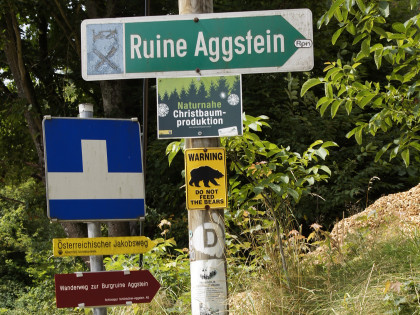
The officially signposted Way of St. James from Maria Langegg (altitude 511) leads to the castle ruins of Aggstein (altitude 501), which can be reached in good an hour. A shortcut recommended by P. Lindenthal leads very steeply down the Langegg mountain and then follows the road along the Aggsbach stream to the Aggsbach Charterhouse in a monotonous manner. The path via the Aggstein ruins is described as a detour. That is true, but what a beautiful one!
We have decided to take the signposted path. The photo on the left was taken below the pilgrimage church at the beginning of the path to the Aggstein ruins.
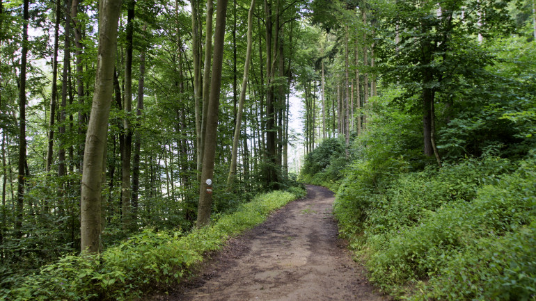
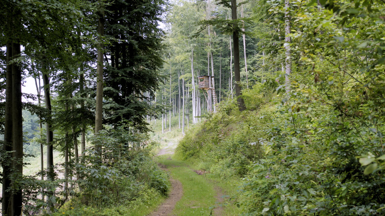
The romantic path through the forest leads with easy ascents and descents to an altitude of 590 m and then back down to the castle ruins.
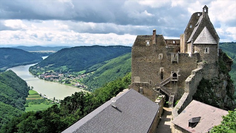
The castle ruin of Aggstein lies high above the Danube. From there you have a wonderful view into the Wachau.
Learn more about Aggstein!
From the ruin the path leads down to the village Aggstein and from there to the charterhouse Aggsbach.
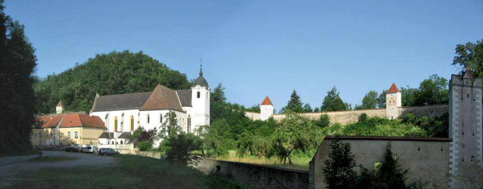
The charterhouse was donated by Heidenreich von Maissau and his wife Anna von Kuenring. In 1373 the foundation stone was laid, in 1377 the first monks moved in (they came from Mauerbach), in 1380 the church was consecrated. The founder calls it "Gate of Our Lady".
In 1387 the sons of the founder donated the parish of Gerolding, which exists since the 12th century, to the monastery. (The village Aggsbach itself belonged to four parishes: Gerolding, Gansbach, Spitz, St. Michael, which led to corresponding friction).
the family of founders, who were highly respected in Austria, continued to provide the monastery with landed property until it died out in the 15th century. Gravestones in the small cloister still point to the Charterhouse as the burial place of the founding family (in the crypt under the choir), as do individual keystones with the heraldic animal of the Maissau, the unicorn.
When the monks of the Prague Charterhouse had to flee from the Hussites in 1419, the number of staff and the library of the scientifically interested Aggsbach monks increased.
The Charterhouse reached its heyday under Prior Vincent (von Aggsbach, 1435-48, died 1464). After his function as Prior he devoted himself to writing, which mainly concerned mystical theology and the Council problem - not to the joy of his Prior, by the way. He was a friend of church and monastery reform and supported the Council of Basel.
Inner courtyard of the Carthusian house
Opposite the Charterhouse stands this Saint Nepomuk. He is gladly included in my
After a short stretch of road the trail leads again into the Dunkelsteiner forest.
The way leads to Wolfstein.
High above the village is a castle ruin.
It dates back to the Babenberg period and was built in 1217 by Perchtold v. Wolfstein. Already in 1240 it became the property of the Kuenringer Alberto V. His son Leutold I. had to pawn the castle. He had participated in an uprising against the first Habsburg Duke Albrecht, which was crushed.
A chapel, which is still preserved today, dates from 1392 and is dedicated to St. James. In the 14th to 16th century the castle was the administrative seat and was inhabited by burgraves of different families.
In 1620 Wolfstein became the property of the Göttweig monastery. The canons were probably more interested in land ownership, the castle lost its importance and gradually fell into disrepair. In 1993 an enthusiastic friend of the castle bought the dilapidated ruin and began to rebuild it.
The wayside shrine depicts St. Wolfgang sitting on this erratic block to rest and eat a piece of bread. But since the sparrows kept nibbling the bread from him, he stomped angrily with his foot and cursed the sparrows. Since then, there have been no sparrows in this area and the erratic block has been split by the enormous kick.
After Wolfstein the path branches off to the right into the Raintal.
Tip: As soon as we come out of the forest, you see this little chapel of the Virgin Mary in the distance (picture). There the Jakobsweg leads past. Following a recommendation by Lindenthal, we save ourselves the detour via Gerolding and turn right at the next hilltop before the wayside shrine. The path leads to the Purzellerhof and to the road that leads from Gerolding to this small chapel of the Virgin Mary.
The yellow signs continue on the road, we follow Lindenthal and turn left. An adventurous forest path leads us to the hamlet of Berging.
We hike along trail 653 to Schönbühel. I wonder where the path is here. Anyway, we have reached the bottom. It would be better to follow the yellow signs from the hamlet of Berging, then you walk on the road, but you will pass the castle of Schönbühel.
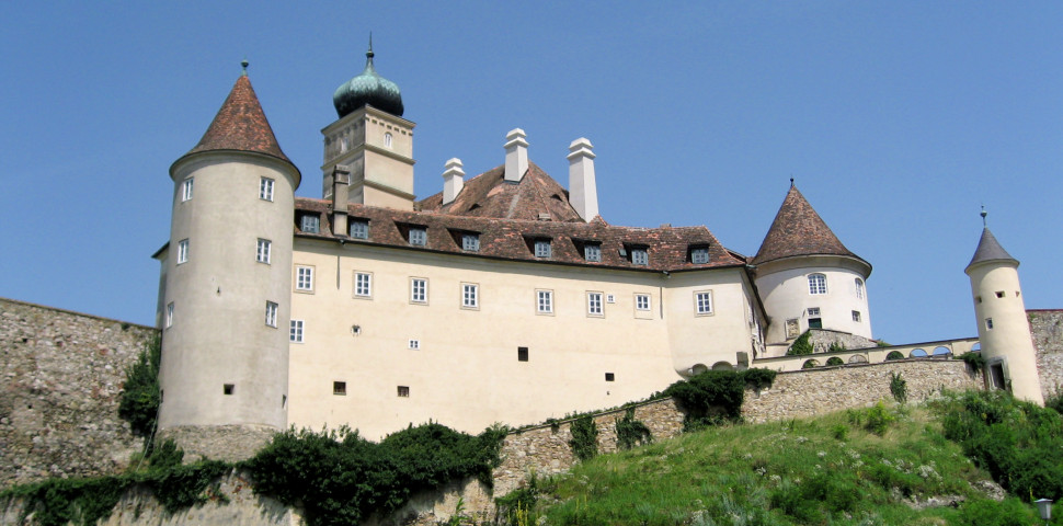
Schönbühel Castle has a long history dating back to Roman times. In 1419, Rüdiger von Starhemberg, Land Marshal of Lower Austria, acquired the castle. In 1499, Bartholomäus von Starhemberg received it. In the 16th century, the Starhembergs, as Protestant nobles, provided a number of Lutheran preachers. It was not until 1639 that the parish was re-catholicised by Count Konrad Balthasar Starhemberg, who returned to Catholicism and founded the monastery in 1666. B. Starhemberg built the monastery for eight years and donated it to the Servites. The Turks invaded Schönbühel in 1683.
The castle was largely renovated around 1821 and thoroughly refurbished after 1900. Until 1929, the castle was owned by the Counts of Beroldingen, who sold it to Count Oswald Seilern-Aspang. The castle is still owned by the family today. It cannot be visited.
On the other hand, the Schönbühel monastery, located about 1 km further downstream, is worth seeing. We have visited it.
Along the Danube we continue towards Melk. There is a lot of bicycle traffic here. It would be better to follow the yellow signs via Hub to Melk. Then also the entry into the city is more beautiful. Finally we want to reach the famous Benedictine monastery Melk.

