From Appenzell (785m) the path leads across the Landsgemeindeplatz past the former Capuchin monastery and then turns right. Via the alley of the Sandgruppe you reach the bypass road, but you only walk along it for a few minutes.
Along the way, the path passes a large storage building of the famous Appenzeller cheese. Immediately afterwards, the route turns onto a beautiful footpath that leads through a meadow valley along the Kaubach up to Gontenbad (895 m). After the spa house there burned down in 1907, the bath almost fell into oblivion. With a new natural moor bath, efforts are now being made to reactivate the spa.
We enjoyed the gentle meadows, which are located in a high valley hollow. Here also begins the barefoot path, which leads not only through velvety meadows but also through some moor fields.
In Gonten there was a chapel dedicated to St. Verena in the late Middle Ages. The pilgrimage route leads through the village.
The Kronberg accompanies us now
There is a chapel of St. James on the Kronberg, which I visited on another occasion.
Isn't this a wonderful path? You almost float along over the meadow.
In Jakobsbad the path leads past the spa hotel.
The monastery "Passion of Christ" in Jakobsbad was built on the place where there was a "bildlin passionis Christi" mentioned in 1687, which was especially venerated by pilgrims. The wayside shrine became a pilgrimage chapel and in the 19th century a monastery church. The convent of the Capuchin nuns is known today for its herbal pharmacy.
After the Passion of Christ monastery, the path (as a contemplation path) leads first as a driveway, but then as a meadow path or forest path over the mountain pastures of Studen (950 m) and Unter-Lauftegg (1000 m) upwards.
Soon you come through a small forest ravine - at the same time the cantonal border between Inner- and Außerrhoden - to the forest-free western slopes with beautiful views over the valley of the Urnäsch. From Chräghof (923 m) you walk along the access road of some mountain farms via Heumösli (888 m) downhill to the road bridge, over which you reach the train station and the village center of Urnäsch (832 m).
The main attraction of Urnäsch are the wooden houses of the 17th and 18th centuries, which also harmonize charmingly with different color paintings and individually executed gable forms. The picture is mainly characterized by the redesign after the village fire in 1641. In the Middle Ages, Urnäsch belonged to Herisau, but has had its own church since 1417. The apostles Philip and James can be traced as church patrons from 1518. The Reformed church was built after the village fire on the foundation walls of the previous building.
A stone sculpture on the village square commemorates the "Silvesterchlausen" with large bells.
After Urnäsch, the trail climbs steeply up to the sunny slopes of Buechen. At a beautiful mountain farm, the marker points to the beginning of a meadow path, which at first is almost level, but then leads more steeply uphill to the wooded ridge.
Soon you approach the Tüfenberg on mostly unwooded slopes. As you go up, the view widens, dominated at first by the Säntis.
Here you must be equipped with a good sense of direction and a good eye for yellow markers to find your way.
At Tüfenberg at 1135 m. is reached the highest point of the hiking route. From here, one looks northward to Lake Constance and to the countless green hilltops on the northwestern edge of the Alps.
Afterwards, the route continues leisurely downhill via the alpine pasture Fohlenweid (1113 m) on farm tracks and meadow paths over the small sandstone ridge Fuchsstein to the village Schönengrund (841 m).
With 500 inhabitants, Schönengrund is the smallest municipality in the canton of Appenzell-Ausserrhoden. The street village with its Reformed church built in 1720 became an independent municipality in the year the church was built. At first glance at the settlement picture, it looks as if the houses north of the Tüfenbach also belonged to the village. In reality, the stream forms the cantonal border of Appenzell-AR and St. Gallen. The houses on the other side of the valley belong to the St. Gallen village of Wald within the municipality of St. Peterzell.
The trail leads via the hamlet of Rüti to St. Peterzell.
The first thing you see of St. Peterzell is a modern (1964), Reformed church with a striking free-standing cubic bell tower.
Then the path leads down to the small village with the former monastery.
The name St. Peterzell recalls a small monastery that existed as early as the 12th century and belonged to the Abbey of St. Johann in Toggenburg as cella Sancti Petri. In 1555 it became a provostry of the monastery of St. Gallen. The place has always been a valued base on the pilgrimage route to Einsiedeln. The present church was built in 1721-23, the monastery building in 1763-64. In 2004-05 a total restoration was carried out. St. Peterzell also has several worth seeing secular buildings from the 17th-19th centuries.
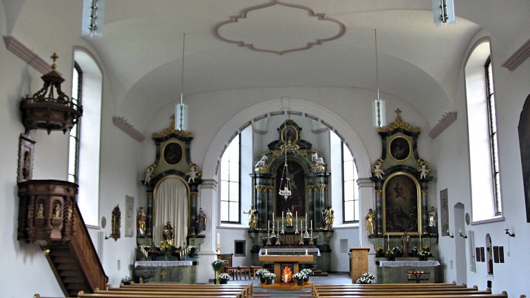
A view into the church

The country inn Schafle is the oldest inn in the village. Here was the cellar of the former provostry in the basement, on the second floor was the courtroom.
This is where we spent the night.
In St. Peterzell the Appenzellerweg joins the Jakobsweg that leads from Rorschach in the direction of Einsiedeln. Therefore, from here on the trail continues with the trail marking "4".

